Archeology
The 1676 Battle of Nipsachuck:
Identification and Evaluation
The Second Battle of Nipsachuck illustrates the evolution in the complexity, sophistication, and effectiveness of English tactics (particularly among Connecticut’s dragoon companies) as well as the aggressive attack and pursuit strategy employed by Connecticut forces throughout the war. Connecticut was the first colony to field fully integrated units of Colonial and Native soldiers throughout the war; a strategy that greatly contributed to the overall success of Connecticut’s King Philip’s War.

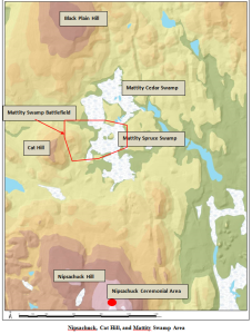
In recognition of the historical and cultural importance of Nipsachuck, the need to identify where and protect the site(s) of the Second Battle of Nipsachuck at Cat Hill and Mattekonnit (Mattity) Swamp and the potentially associated ceremonial area at nearby Nipsachuck Hill (map shown below), the Rhode Island Historical Preservation & Heritage Commission (RIHPHC), the Narragansett Indian Tribal Historic Preservation Office (NITHPO), and the Blackstone Valley Historical Society (BVHS), received a National Park Service American Battlefield Protection Program (NPS ABPP) grant “Second Battle of Nipsachuck, Site Identification and Documentation” (GA-2255-11-016) to identify and document the Second Battle of Nipsachuck (Mattity Swamp Battlefield) and the potentially associated ceremonial area located at Nipsachuck Hill one mile to the south.

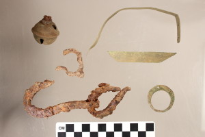
Images of artifacts discovered at the Nipsachuck Battle site, including iron pieces, scrap brass, and other domestic items.
The battlefield survey identified approximately 150 battle-related and domestic objects within the 67-acre battlefield bounded in part by Cat Hill on the west and Mattity Swamp on the north, east, and south. The nature and distribution of battle-related artifacts documents the avenues of attacks by the two wings of dragoons and their Mohegan and Pequot allies, the initial envelopment of the Narragansett camp, the pursuit of the Narragansett as they retreated into Mattity Swamp, and the encirclement and final phase of the battle. The survey of the Nipsachuck Ceremonial Area identified a stone enclosure (wall) encompassing an area of approximately two acres containing approximately 265 stone features.

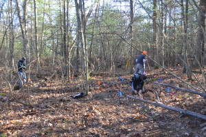
Archaeologists surveying the Nipsachuck Battlefield site using metal detectors, and marking identified artifacts using flags.


